
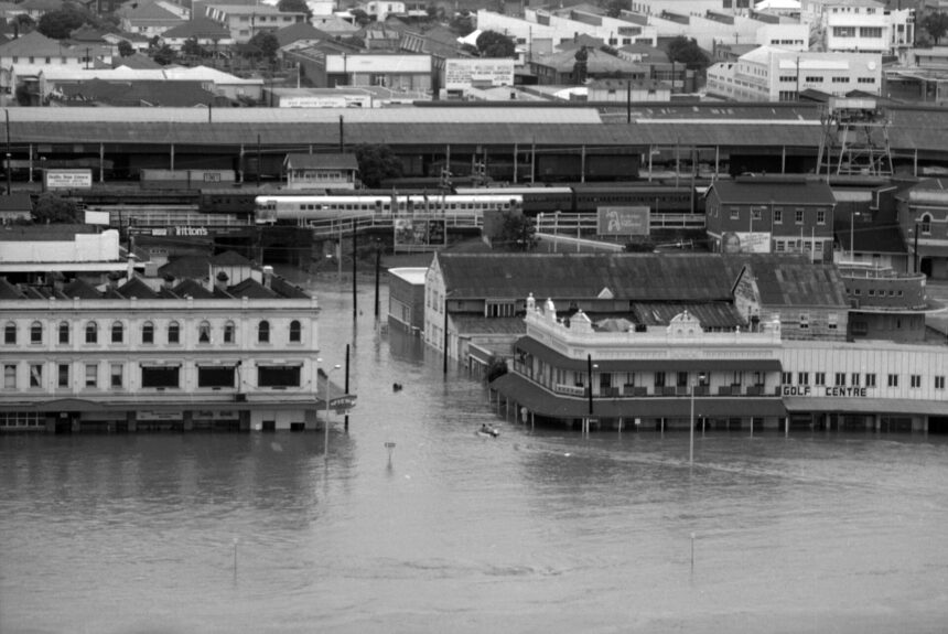
This guide sets out what government, library and archive sources say about the January 1974 flood in Brisbane, and it shows where their figures differ rather than choosing one. A companion guide covers the 2011 Brisbane floods.
What led to the flood
The State Library of Queensland (SLQ) records that Tropical Cyclone Wanda crossed the Queensland coastline near Maryborough in January 1974. The Queensland Reconstruction Authority (QRA) says the spring of 1973 had been extremely wet, so the catchment was already saturated.
Rainfall figures vary by source and by what is being measured. SLQ, citing the Bureau of Meteorology, says rainfall in the Brisbane area ranged from 500 mm to 900 mm over the period. The same SLQ page reports that Mount Glorious recorded the highest five-day total, 1318 mm. The QRA says 900 mm had been recorded by 29 January 1974.
For the heaviest single day the sources do not agree. Historian Margaret Cook, writing in the Rachel Carson Center’s Arcadia series, gives 314 mm on 26 January, while the QRA says more than 500 mm fell in a 24-hour period in Brisbane. The sources read here do not explain the difference, so no single figure is given.
How high did the river rise?
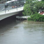
The QRA describes the late-January 1974 flood as the largest to affect Brisbane City in the 20th century. Measured at the Brisbane City gauge, it peaked at 5.45 metres. Cook also gives 5.45 m for the crest in the city on 29 January.
Quoted heights depend on which gauge is used. The Queensland Floods Commission of Inquiry noted that two gauges at the Brisbane Port Office recorded different maximums in the 2011 flood, with readings of 4.46 metres AHD (Seqwater gauge) and 4.27 metres (Maritime Safety Queensland gauge). A height should therefore be read together with its gauge.
It was not the highest flood on record: the QRA says the largest recorded flood occurred in 1841. It says the February 1893 flood rose seven metres above ordinary levels and left inner-city South Brisbane completely submerged. The QRA also says the January 2011 peak at the city gauge, 4.46 metres, was one metre lower than in 1974.
Homes and lives affected
The figures differ, and the reasons are not fully explained by the sources.
- SLQ says at least 6,700 homes were partially or totally flooded in the Brisbane metropolitan area.
- Cook says about 13,000 homes across 30 suburbs were affected, and the QRA refers to tens of thousands of homes.
- In Ipswich, SLQ reports approximately 1,800 residential or commercial premises partially or totally inundated. The QRA says 41 houses there were washed away.
On deaths, SLQ records that 16 lives were lost. Cook gives 14 deaths in Brisbane.
What changed afterwards
The QRA says Wivenhoe Dam was built after the 1974 flood, with construction completed in 1985.
The 2012 Floods Commission report says Brisbane City Council used the same flood level, 3.7 metres at the Port Office gauge, for planning controls from 1976 until March 2011. That level was adopted in 1976 as the peak the 1974 flood would have reached had it been mitigated by Wivenhoe Dam. The same report records that, after the 1974 flood, the council joined the Queensland and Commonwealth governments in a jointly funded compulsory and voluntary house purchasing scheme.
Records and archives
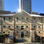
An account of recovering flood-damaged documents, written by Queensland State Archives staff, described the Australia Day weekend of 1974 as bringing the most damaging floods ever to hit the city. The Archives’ own building sat on a hillside well away from the river and escaped the water. They dated the floods to the period 25 to 31 January.
Some government departments’ records were affected. Records of the Children’s Services Department, stored in a Mary Street basement, were submerged for about three days under two metres of water. The authors wrote that quite a few departments had lost the bulk of their records.
Where to find the primary material
SLQ’s oral history collection “Washed Away” (OH32) contains fourteen cassette tapes and logs of interviews about the flood. The Queensland Government’s open data portal lists a layer showing the 1974 flood extent inside the Brisbane City Council area, created in June 2013. For current flood risk at an address, see Brisbane flood preparedness basics and check Council’s flood information for the property.
Frequently asked questions
How high did the Brisbane River get in January 1974?
The QRA says the flood peaked at 5.45 metres at the Brisbane City gauge.
Why was Wivenhoe Dam built?
The QRA says Wivenhoe Dam was built following the 1974 flood, with construction completed in 1985.
How many homes flooded in 1974?
Sources differ: SLQ says at least 6,700 homes in metropolitan Brisbane, while Cook gives about 13,000 homes across 30 suburbs.
Was 1974 the biggest Brisbane flood?
The QRA calls it the largest of the 20th century but says the largest recorded flood was in 1841.