
This guide lists the routes Brisbane City Council and the Queensland Government describe on their pages, read on 10 November 2026. It gives only the lengths and endpoints those pages state, and where two pages disagree it shows both. Road rules are covered in Cycling in Brisbane: Rules and Tips, and gentler paths for children in Kid-Friendly Bike Paths in Brisbane.
Planning with the council map
At 10 November 2026, council’s bikeways page says you can plan a ride and view individual cycle lane details using its interactive Community Maps application. At 10 November 2026, the page also says some of Brisbane’s bikeways might not be open due to flood damage, maintenance, repairs or upgrades. At 10 November 2026, council’s closures page tells riders to check bikeway and shared path closures and detours before riding. At 10 November 2026, council says personal mobility devices such as e-scooters and e-skateboards are allowed on Brisbane’s bikeways.
Along the river and the western corridor
At 10 November 2026, council describes the Bicentennial Bikeway as an off-road 4.8 km pathway along the Brisbane River from Toowong to the Brisbane CBD. At 10 November 2026, it says the route features separate bike and pedestrian paths. For other riverside paths, see Brisbane Riverwalk Guide.
At 10 November 2026, council says the Western Freeway Bikeway leads into the Centenary Cycleway, a dedicated connection from Toowong to Ellen Grove. At 10 November 2026, it also says this bikeway connects to the Bicentennial Bikeway at Toowong.
Creek bikeways
At 10 November 2026, council’s bikeways page describes the Bulimba Creek Bikeway as an off-road shared path of about 20 km from Murarrie to Eight Mile Plains. At 10 November 2026, it says the relatively flat path has many shady sections alongside the creek through parks and open fields. At 10 November 2026, council’s FAQ says this is the longest bike path in Brisbane. At 10 November 2026, the page offers a Bulimba Creek map PDF, Murarrie to Wishart, which it shows as last modified October 2024.
Council’s pages give two lengths for the Kedron Brook Bikeway between Mitchelton and Nundah. At 10 November 2026, the bikeways page says it is almost 20 km long and a mix of separated bikeways and off-road shared pathways, while, at the same date, the walking and hiking page describes a 16 kilometres flat path. This guide does not settle the difference; check the council map for the section you plan to ride. At 10 November 2026, the bikeways page says that at Nundah the route becomes the Jim Soorley Bikeway, which connects to Nudgee Beach and the Boondall Wetlands Bikeway.
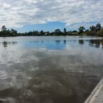
At 10 November 2026, council’s bikeways page describes the Enoggera Creek Bikeway as a paved, shared-use pathway connecting Ashgrove, Red Hill and Newmarket to Windsor and Herston. At 10 November 2026, it says the path is generally flat, with green spaces including Spencer Park, Finsbury Park and Downey Park. At 10 November 2026, the council’s walking and hiking page describes it as a multi-use, 13-kilometre pathway following the creek through a series of parks.
Wetlands and the northern corridor
At 10 November 2026, the bikeways page lists the Boondall Wetlands Bikeway as about 4 km long, starting at the Boondall Wetlands Environment Centre and leading to Nudgee Road. At 10 November 2026, it says the Boondall flat route offers views of marshlands, woodlands and mangroves. At 10 November 2026, council’s Boondall Wetlands page instead describes a shared bikeway trail as a 13-kilometre return journey, and, at the same date, its FAQ says the bikeway extends from the Brisbane Entertainment Centre to Nudgee Beach. The pages differ, so confirm the route on the council map. For the reserve itself, see Boondall Wetlands Guide: Walks, Birds and Visiting.
At 10 November 2026, council says the North Brisbane Bikeway route is 7.5 km and includes 4.5 km of separated paths. At 10 November 2026, it says you can reach the Ithaca Creek, Enoggera Creek or Kedron Brook Bikeways from it. At 10 November 2026, the Queensland Government’s maps and routes page, which shows no last-updated date, describes a 7.5km bike riding and walking path from Wooloowin to the Brisbane CBD.
Veloway 1
At 10 November 2026, council describes Veloway 1 as a dedicated 3-metre-wide bikeway for bikes and e-mobility devices from South Brisbane to Slacks Creek. At 10 November 2026, it says the route connects to the Brisbane CBD via the Goodwill Bridge. At 10 November 2026, the Queensland Government’s maps and routes page, which shows no last-updated date, describes it as a 20km bikeway along the Pacific Motorway on Brisbane’s southside.

Path types and facilities
At 10 November 2026, council’s safety page says one side of a separated pathway is for pedestrians and the opposite side for people riding bicycles, e-bikes, wheeled recreational devices and personal mobility devices. At 10 November 2026, it says you can’t walk on bicycle only pathways.
At 10 November 2026, council’s parking page says there are more than 400 bike racks installed around Brisbane. At 10 November 2026, the same page says council’s bike repair stations can be used for basic repairs including inflating a tyre, and, at the same date, lists one near the base of the Wheel of Brisbane on the Clem Jones Promenade, South Brisbane. At 10 November 2026, it also says you can’t take your bike on Brisbane buses unless you have a foldable bike.
Frequently asked questions
What does council say is the longest bike path in Brisbane?
At 10 November 2026, Brisbane City Council’s bikeways page says the Bulimba Creek Bikeway is the longest bike path in Brisbane, and describes it as about 20 km from Murarrie to Eight Mile Plains.
Are all Brisbane bikeways always open?
At 10 November 2026, council’s bikeways page says some bikeways might not be open due to flood damage, maintenance, repairs or upgrades, and its closures page tells riders to check closures and detours before riding.
Are e-scooters allowed on Brisbane bikeways?
At 10 November 2026, council says personal mobility devices such as e-scooters and e-skateboards are allowed on Brisbane’s bikeways.