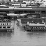

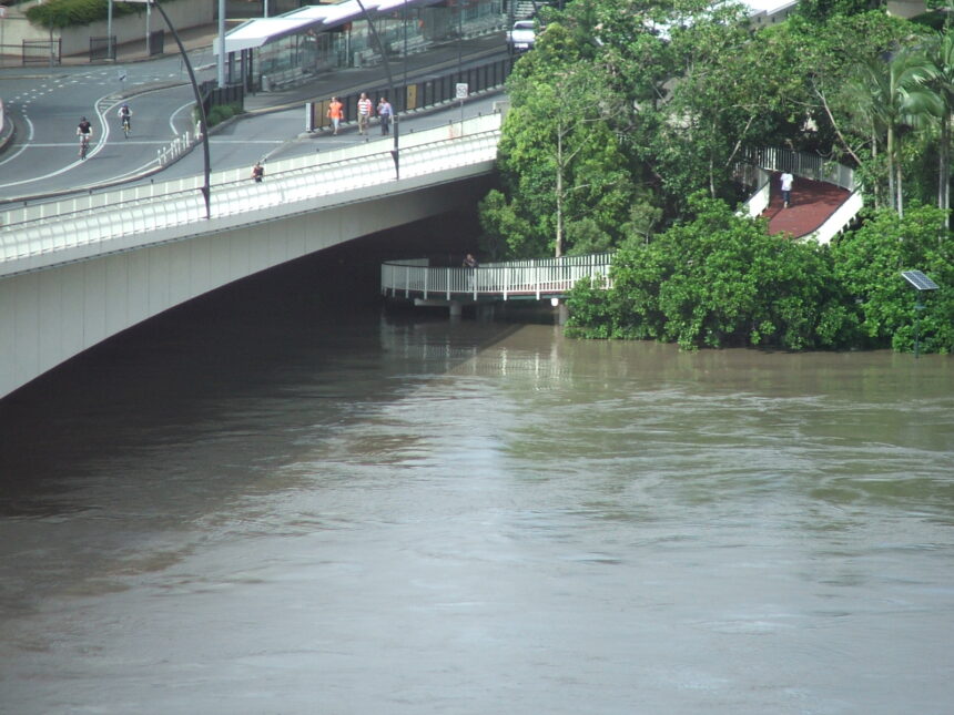
The January 2011 floods affected a very large part of Queensland: the Commission of Inquiry reports that more than 78 per cent of the state was declared a disaster zone. This guide uses the Queensland Floods Commission of Inquiry’s 2012 final report, the Queensland Reconstruction Authority (QRA) and the State Library of Queensland (SLQ), and it flags where figures differ. For the earlier flood of 1974, see the Great Flood of 1974 explained.
What happened
The Commission of Inquiry said prolonged and extensive rain over large areas of Queensland, falling on already saturated catchments, led to flooding of historic proportions in December 2010 and into January 2011. Commissioner Catherine Holmes wrote that the floods which struck south-east Queensland in the week of 10 January 2011 were unprecedented and in many places completely unexpected.
The state-wide figures from the Commission’s report are:
- Thirty-three people died and three remained missing. SLQ also gives 33 deaths.
- More than 78 per cent of the state was declared a disaster zone, and over 2.5 million people were affected.
- Some 29,000 homes and businesses suffered some form of inundation. The QRA gives the same approximate figure.
SLQ gives a different measure, saying 28,000 homes were in need of rebuilding. This guide’s reading is that the figures count different things (the Commission counts homes and businesses inundated; SLQ counts homes needing rebuilding), so the two numbers are not interchangeable. SLQ adds that approximately 5,900 people were evacuated from their homes during the crisis.
The Brisbane River peak
The Commission reported that the two gauges at the Brisbane Port Office recorded different maximums in January 2011: 4.46 metres AHD on the Seqwater gauge and 4.27 metres on the Maritime Safety Queensland gauge. As at the Commission’s 2012 report, it recommended that the Queensland Government resolve the discrepancy; whether that has since happened has not been checked. The QRA says the river peaked at 4.46 metres at the city gauge, one metre less than in 1974. The peak at the Port Office gauge occurred at 3.00 am on 13 January 2011.
So 4.46 metres is one gauge’s reading, and the Commission shows the second gauge reading lower. Note the naming: the QRA calls its gauge the city gauge, the Commission’s discussion refers to the two Port Office gauges, and Recommendation 16.5 names the Brisbane City and Port Office gauges. The sources read do not say whether the city gauge and a Port Office gauge are the same instrument, so this guide does not equate them. The 1974 comparison is covered in the Great Flood of 1974 explained.
Wivenhoe Dam and the Commission’s findings
The Commission’s report states that the flood would have been worse in Brisbane if there were no dams. It also records that it was not disputed that releases from Wivenhoe contributed significantly to flooding downstream.
The Commission asked an independent expert to model how much each source contributed; subject to considerable qualification, the modelling found that Wivenhoe and non-Wivenhoe sources were roughly equivalent contributors to peak flow from Moggill to Brisbane. Between 6 and 13 January 2011, releases made up approximately half of the total flood volume at the Port Office. The Commission cautioned that this does not mean half of the flooding in Brisbane was caused by the releases.
On operations, the Commission found that Wivenhoe Dam was operated in breach of its manual from 8.00 am on 8 January 2011 until the evening of 9 January 2011. It also said the manual itself was ambiguous, unclear and difficult to use, and not based on the best, most current research. The Commission recommended that the Crime and Misconduct Commission investigate the conduct of three flood engineers, while making no finding on whether any offence or official misconduct was established. This guide does not report what happened after that referral because it has not been confirmed from a full-text official source.
The inquiry and its timeline
The Commission was established on 17 January 2011. It was set up to inquire into seven matters arising out of the floods. It gave the Queensland Government an interim report on 1 August 2011, which recommended lowering Wivenhoe’s full supply level to 75 per cent in the 2011/2012 wet season if the Bureau predicted another wet season of similar proportions, a step that was taken.
The final report’s due date was extended to 16 March 2012 so that further evidence on dam operations could be taken. The Queensland Government says the report was released that day.
Flood study and planning after 2011
Brisbane City Council had used 3.7 metres at the Port Office gauge as its flood planning level from 1976 to March 2011. That level had been adopted on the basis of what the 1974 flood would have reached had Wivenhoe Dam mitigated it. The QRA says the Brisbane River Catchment Flood Study was completed in early 2017.
The State Library and records
SLQ says Brisbane’s South Bank, including the State Library building, was inundated. It adds that the building’s lower level was inundated with floodwaters. For household preparation, see Brisbane flood preparedness basics.
Frequently asked questions
How high was the Brisbane River in January 2011?
The QRA says it peaked at 4.46 metres at the city gauge. The Commission notes that two Port Office gauges recorded 4.46 m and 4.27 m.
How many people died in the 2011 Queensland floods?
The Commission’s report says 33 people died and three remained missing.
What did the Floods Commission find about Wivenhoe Dam?
It found the dam was operated in breach of its manual from 8.00 am on 8 January to the evening of 9 January 2011, and said the manual itself was ambiguous and unclear.
When did the Floods Commission report?
An interim report was provided on 1 August 2011, and the final report was due 16 March 2012 after an extension.