
This guide covers bushwalks around Brisbane other than the tracks already described in our separate guides. For Mount Coot-tha see the Mount Coot-tha Walking Tracks Guide, for the Glass House Mountains see the Glass House Mountains Guide, and for Lamington see the Lamington National Park Day Trip Guide. If you are newer to bush tracks, start with the Brisbane Walking Trails for Beginners guide.
Distances, times and difficulty ratings below come from the Visit Brisbane hikes page unless a council page is named, as listed and checked 9 November 2026. Visit Brisbane’s difficulty labels are its own, and conditions and closures can change, so check the managing agency before you go.
Northern and north-western walks
Visit Brisbane lists the Holmans Break walk at Walkabout Creek as a 12.7 km trek taking about five hours, rated moderate, starting at the bottom car park at Walkabout Creek. It lists the Gold Creek Reservoir walk at Upper Brookfield as the 5.5 km dam circumference, taking two hours, rated moderate.
In Brisbane Forest Park, it lists the Araucaria Track as a 5 km walk taking 90 minutes, rated easy. The Morelia walking track at Mount Nebo in D’Aguilar National Park is listed as a 6 km walk rated hard, and the Mermaid Mountain hike as 13.2 km, rated hard, starting from the town of Mount Crosby.
The same page lists the Bunyaville Track as a 2.9 km loop taking about 30 minutes, rated easy. The Boondall Wetlands Bikeway is listed at 13 km and about three hours to walk, rated easy.
Western walks
Visit Brisbane lists the Lake Manchester Loop as a hilly 17 km clockwise loop rated hard, located 25 km west of Brisbane. The council places Changing Mountain Bushland on the outskirts of Brisbane in Kholo and describes a mix of moderate and hard tracks with challenging slopes. Leashed dogs are allowed there, the council says.
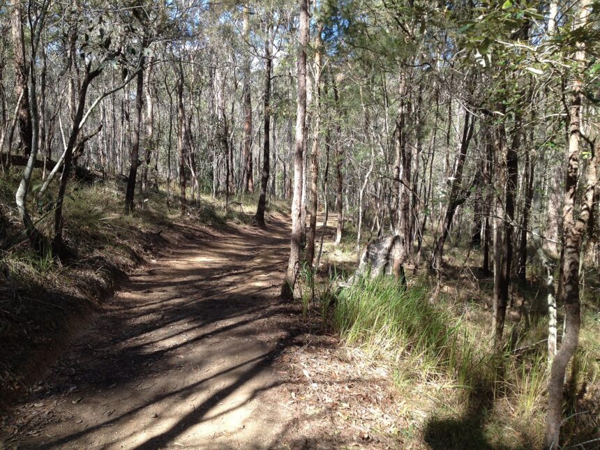
The reserve’s tracks are designated multi-use routes shared by walkers, cyclists and horse riders, and numbered markers at intersections help with navigation. The council does not list track names or lengths on the page itself, so download its track map before you go. It lists koalas, kangaroos and red-necked wallabies, along with rare birds including the glossy black cockatoo. The council also warns of large washouts, ruts and uneven surfaces on some tracks, patchy mobile reception, and picnic shelters that may have no drinking water.
Southern walks
The Buhot Creek Circuit in Daisy Hill Conservation Park is listed as a 9 km walk of about three hours, rated moderate. The Venman Circuit in Venman Bushland National Park is listed as a 7 km circuit, allowing 2.5 hours, rated easy. The Stockyard Creek walking track in Brisbane Koala Bushlands is listed as 1.4 km, a one-hour loop, rated easy, and the Federation Track at Mount Gravatt as a 3 km round trip taking just over an hour, rated easy.
Toohey Forest Park covers about 260 hectares, according to the council. Its tracks range from easy to hard, on both paved and unpaved surfaces, and wind through sandstone and quartzite outcrops and eucalypt forest. The council lists the Mount Gravatt Summit Track at 1.2 km and about 40 minutes, running from Gertrude Petty Place to the Mount Gravatt Outlook. It says the forest park and the Mount Gravatt Outlook Reserve together hold more than 400 species of native wildlife and plants. Bouldering is allowed only in two designated areas.
Council bushland reserves in more detail
Brisbane City Council describes Karawatha Forest as covering about 900 hectares and offering more than 42 kilometres of walking and shared-use tracks. It lists 30 easy, moderate and hard walking tracks, ranging from 488 metres to 2.6 kilometres. Leashed dogs are allowed, and mountain bikes may be ridden on designated trails.

The landscape ranges from freshwater lagoons and sandstone ridges to dry eucalypt forests and wetlands. The council says the forest forms part of the largest remaining stretch of open eucalypt bushland in South East Queensland. More than 200 species of wildlife use it, and nearly 120 bird species are recorded. The council also credits Karawatha with Brisbane’s highest diversity of frog species, including the vulnerable wallum froglet and tusked frog.
For access, the main car park is at the Discovery Centre off Acacia Road, and a smaller car park is near the picnic area at the southern end. The council also lists an entry via Illaweena Street.
The council says Brisbane Koala Bushlands has two main shared trails and one designated walking trail, ranging from 1.4 to 6.2 kilometres. As listed on the council page, checked 9 November 2026, the Alperton Road site and J. C. Trotter Memorial Park there are open 8am to 6pm daily, and leashed dogs are allowed.
Before you go
Confirm current track status and any closures with the managing agency before setting out. The council advises Karawatha visitors to carry water, a track map and a mobile phone, and to tell someone where they are going and when they expect to return. Some Karawatha tracks cross creeks that may be unsafe to cross after heavy rain. Our Brisbane Outdoor Safety: Heat, Storms and Sun guide covers conditions more broadly.
Frequently asked questions
Are dogs allowed on bushwalks at Karawatha Forest?
The council says leashed dogs are allowed in Karawatha Forest, and mountain bikes may be ridden on designated trails.
Where can I find track names and lengths for Changing Mountain Bushland?
The council page does not list them; it points to a downloadable track map.
What should I carry on a Brisbane bushwalk?
For Karawatha, the council advises carrying water, a track map and a mobile phone, and telling someone your plans.
How long is the Mount Gravatt Summit Track?
The council lists it at 1.2 km and about 40 minutes.