
Brisbane’s riverside paths are not one single trail, so this guide treats them as connected stretches that Brisbane City Council and the Lord Mayor’s office describe in separate places. Details below are as listed on those pages, checked 9 November 2026, and can change.
The wider river network
Brisbane City Council’s River Access Network is made up of eight river and recreation hubs. The council names them as New Farm Park, City Botanic Gardens, Murarrie, West End, Dutton Park, Northshore Hamilton, Kingsford Smith Drive and Riverhills. The council says the network supports recreation and tourism on the river, serving tour boats, powered recreational vessels and passive craft such as kayaks, canoes and stand-up paddleboards.
City Botanic Gardens Riverwalk
The council lists this riverwalk as extending from the City Reach Boardwalk, at the corner of Alice Street and Edward Street, to Bunya Walk. It describes the walk as a shared riverside pathway that gives access to the City Botanic Gardens River Hub.
A Lord Mayor media release dated 23 April 2022 said the City Reach Boardwalk and the City Botanic Gardens Riverwalk were the final pieces to open after flooding. The same release said the flood event affected more than 175 km of bikeways and pathways and that council crews cleared and cleaned more than 56 bikeways across Brisbane. It called the boardwalk one of the city’s busiest cyclist and pedestrian corridors, said the two paths link Toowong to Howard Smith Wharves, and said they connect users to riverfront dining and the Howard Smith Wharves precinct.
The release also noted that the Bicentennial Bikeway had reopened the week before, after the State Government removed the Drift Restaurant, which had blocked a key section. It said riders could then connect from the Toowong to Howard Smith Wharves route to New Farm and Hamilton.
The River Hub on the water
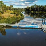
The City Botanic Gardens River Hub is at 147 Alice Street, Brisbane City. At 9 November 2026, per the council’s River Hub page, the hub has pick-up and drop-off points for tour boats and water taxis, plus short-term berthing for powered and passive vessels. At 9 November 2026, per the same page, the inner pontoon is intended for recreational and passive vessels of up to 25 tonnes, while the external side of the outer pontoon is for commercial and tour boats of up to 200 tonnes. At 9 November 2026, per the same page, users of the inner fingers of the pontoon can stay up to 2 hours with no bookings. At that date the page also said no overnight mooring is allowed, and that fishing off the pontoons is permitted but boating takes priority, with net casting and crab pots not allowed.
New Farm to the city
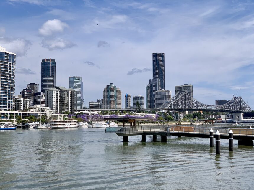
Visit Brisbane describes the Brisbane Riverwalk as linking New Farm with the city, ending at Howard Smith Wharves where it joins the riverside boardwalk and continues to the Botanic Gardens. It says the structure was rebuilt after the 2011 flooding and is built to withstand a one-in-2000-year flood. It also says the cycling and pedestrian pathways are segregated and that an opening span lets vessels reach the shoreline. For people starting from New Farm, the same page says the path can be accessed from Riverview Court.
For the park itself, see the New Farm Park Guide.
Newstead to Teneriffe and New Farm Park
The council’s walking guide suggests heading to Waterfront Park at Newstead and following the Riverwalk signs toward the Teneriffe ferry terminal. It continues past Gasworks and Brisbane Powerhouse to New Farm Park. The council lists the walk as pram and scooter friendly and notes an off-leash area at Powerhouse Park.
South Bank Parklands Promenade
The council’s guide says the promenade begins at the Cultural Forecourt and finishes at River Quay. It describes the parklands as 17 hectares with eateries and river views, and mentions a longer 4-kilometre walk that extends to Kangaroo Point.
Kangaroo Point Cliffs
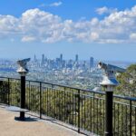
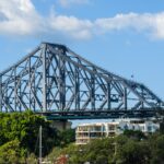
The council describes the Cliffs Boardwalk as starting at the Riverlife Adventure Centre and ending under the Captain Cook Bridge. Another council page describes the river walk and cycle path as including sculptures, viewing platforms, picnic and barbecue spots, and city views. That page gives the address as 29 River Terrace, Kangaroo Point, and lists the walk as pram and scooter friendly.
Indooroopilly Riverwalk
Per a 4 June 2021 Lord Mayor media release, the Indooroopilly Riverwalk is a 790-metre separated bridge along the riverbank between Twigg Street and the Jack Pesch Bridge. It is a separated two-way cyclist and pedestrian riverwalk, built on 88 piles along the riverbank. The release said it links to the Indooroopilly Railway Station and gives a safer connection to the Jack Pesch Bridge, which averaged 1,400 cyclists and 540 pedestrians a day at that time.
The release described construction as taking 14 months and about 230,000 hours of work by more than 60 local workers. It said the project was delivered six months ahead of schedule and under budget, with bridge decks, pile liners and steel handrails sourced from Seventeen Mile Rocks, Wacol and Brendale. The release quoted Councillor James Mackay as saying the riverwalk would be open for use on Sunday 6 June, with a community launch event that day.
Nearby guides
For hill walking away from the river, see the Mount Coot-tha Walking Tracks Guide.
Frequently asked questions
Where does the City Botanic Gardens Riverwalk run?
The council lists it as running from the City Reach Boardwalk, at Alice Street and Edward Street, to Bunya Walk.
How long is the Indooroopilly Riverwalk?
A 2021 Lord Mayor media release described it as a 790-metre separated bridge between Twigg Street and the Jack Pesch Bridge.
Where does the Kangaroo Point Cliffs Boardwalk start and end?
The council says it starts at the Riverlife Adventure Centre and ends under the Captain Cook Bridge.