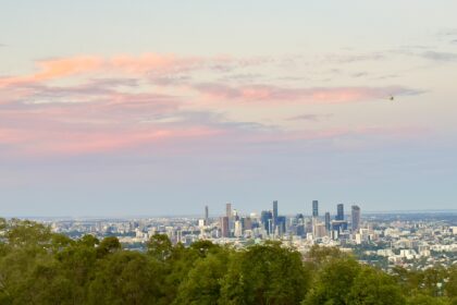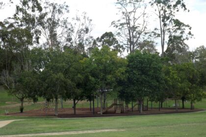
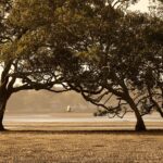
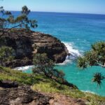

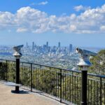
The council’s Toohey Forest page, read on 9 November 2026, describes the park as just 10 minutes from Brisbane’s CBD and says it covers about 260 hectares. The same page says the park is home to a diverse range of wildlife and includes picnic areas, walking tracks and shared trails. The council page, read on 9 November 2026, says it also offers scenic views of the city and the surrounding suburbs.
The council’s track map, last modified 21 December 2021, says koalas, echidnas and gliders live in the forest, along with more than 75 species of birds. The council page, read on 9 November 2026, says the walking trails and the Griffith University Intercampus Link connect Toohey Forest Park to Mount Gravatt Outlook Reserve. The council page, read on 9 November 2026, says that reserve covers 91 hectares.
Landscape and plants
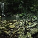
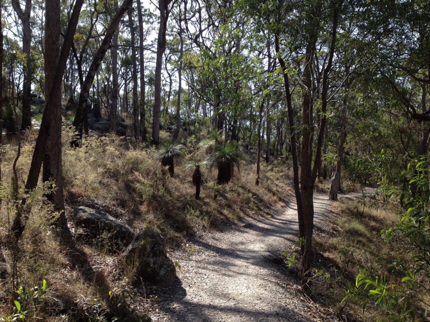
The council’s track map, last modified 21 December 2021, says extensive walking tracks wind through large sandstone outcrops and eucalypt forest. The same map says grass trees and banksias are scattered throughout the understorey. The same map adds that these plants are particularly spectacular when wildflowers are in bloom in late winter and spring.
Picnic areas
The track map (last modified 21 December 2021) gives four picnic areas located throughout Toohey Forest, where visitors can enjoy barbecue and picnic facilities. The council’s Toohey Forest page, read on 9 November 2026, says you will find 2 picnic areas at Toohey Forest Park, each with barbecues. The same page says Mount Gravatt Outlook Reserve has 2 picnic areas. The two council sources do not agree on the number inside Toohey Forest, so check the council page before you plan a picnic.
Walking tracks
The track map (last modified 21 December 2021) gives the Nathan Ridge Track as 3.5 km, which takes about one hour. The same map gives the Toohey Ridge Track as 3 km, also about one hour, and says it extends from the Toohey picnic area along the ridgeline to the South East Freeway. The same map says Planchon’s stringybark and Bailey’s stringybark feature along this track, and that both trees are significant because they are not commonly found in Brisbane.
The track map (last modified 21 December 2021) gives the Sandstone Circuit as 750 m, or about 30 minutes, and says it begins at the Toohey picnic area, where it meanders up the sandstone knoll. The same map says the Toohey Mountain Track leaves from the Mayne Estate picnic area and follows the ridge south to Pegg’s Lookout. The same map says the Summit Track begins at Gertrude Petty Place and leads to Mt Gravatt Outlook.
The track map (last modified 21 December 2021) says in its introduction that visitors can take a bike ride along the Toohey Ridge and Nathan Ridge tracks. The same map’s Bikeway safety section sets a stricter rule. Within Toohey Forest and Mount Gravatt Outlook Reserve, bike riding is only permitted on designated bikeways which are Lophostemon Track, Nathan Ridge Track, Dellwood Track, Intercampus Link and the Tarragindi Bikeway Link. The Toohey Ridge Track is not one of the named bikeways.
The council page, read on 9 November 2026, says visitors can choose from easy, moderate and hard tracks on both paved and unpaved trails, and it invites them to download the track map to find the right track.
Lookouts and views
The track map (last modified 21 December 2021) says the lookouts provide spectacular views of Brisbane and surrounding suburbs. The same map says that on a clear day, the Moreton Bay islands, the D’Aguilar Ranges and the Glasshouse Mountains can be seen from Mt Gravatt Outlook. It also says that from Pegg’s Lookout you overlook Archerfield towards Ipswich, Flinders Peak and ranges beyond. The council page, read on 9 November 2026, says the summit includes a café, playground and toilet block.
Getting there
The council page, read on 9 November 2026, gives the park’s address as 600 Toohey Road, Nathan Qld 4111. The same page says cars can access Toohey Forest from Toohey Road, Tarragindi, and that walkers can access trails in the forest and the reserve from the surrounding streets.
Rules and track conditions
The same page advises that you keep your dog on a leash, stay on the designated tracks, dispose of rubbish and dog waste responsibly, and not touch or interfere with local wildlife and plants.
As at 9 November 2026, the council’s tracks update warned that tracks may be affected by rainfall and overland flow, and that large washouts, ruts and uneven surfaces may be present on some tracks. Check the council page before you go.
Council land management
The track map, last modified 21 December 2021, says Brisbane City Council manages and cares for more than 9900 hectares of bushland and wetland reserves.
Frequently asked questions
Is Toohey Forest Park good for wildlife spotting?
The council track map, last modified 21 December 2021, says koalas, echidnas and gliders live in the forest, with more than 75 species of birds.
How long is the Nathan Ridge Track?
The council track map, last modified 21 December 2021, lists the Nathan Ridge Track at 3.5 km, which takes about one hour.
Can I take my dog?
The council page, read on 9 November 2026, advises keeping your dog on a leash and staying on the designated tracks.
Can I ride a bike on the Toohey Ridge Track?
The track map (last modified 21 December 2021) says in its Bikeway safety section that bike riding is only permitted on designated bikeways within Toohey Forest and Mount Gravatt Outlook Reserve, and the Toohey Ridge Track is not one of them.