




The Council’s Stones Corner Heritage Trail page, read on 13 November 2026 (the linked trail guide is shown as last modified 15 April 2025), describes a 2.3 kilometre self-guided trail with 11 points of interest through the historic high street and nearby landmarks. It begins at Burnett Swamp Bridge on Logan Road near Old Cleveland Road and finishes at Langlands Park on Panitya Street. The page describes the flat route as possibly suitable for explorers with accessibility requirements and notes that privately owned heritage places are not open to the public and must be viewed from streets.
How Stones Corner got its name
According to the introduction on the trail page, the suburb takes its name from early European resident James Stone, who bought land between Logan and Cleveland Roads in 1875. The page says Stone cleared dense scrub to build a two-room slab hut and, unable to get a licence to sell alcohol to travellers, sold ginger beer instead. It adds that a horse-drawn omnibus service in 1883 made the area more accessible, and that local shops sprang up along Logan Road, which remains the high street today. By 1887, the page says, Stone had sold his property for 25 times its purchase price, and in the following year a hotel replaced his hut.
The introduction also records a flood in 1893, when locals were cut off from the city, followed by another flood in 1898. It says an electric tram made the Logan Road shopping strip more accessible by 1902, and that by the 1920s the area was a thriving commercial hub. On boundaries, the page says Stones Corner was integrated into the City of Greater Brisbane in 1925, and regained its status as a separate suburb in 2017 after a two-year resident campaign.
Burnett Swamp Bridge and the Logan Road buildings
Stop 1, Burnett Swamp Bridge, is introduced through the open wetland around Norman Creek that was known as Burnett Swamp before Stones Corner was established. The page says a causeway and culvert crossed the creek by 1865, and that a new bridge was completed in 1894 after at least five years of planning and negotiation. It says a replacement designed under the supervision of C.B. Mott was completed in 1928. The page adds that this bridge was named the Buranda Bridge but continued to be popularly known as the Burnett Swamp Bridge.



Stop 2, Thomason’s Buildings at 273 Logan Road, is described as the most visible Stones Corner landmark for almost a century, built in 1925 and commissioned by Thomas Watson Thomason. The page says Thomason was a pharmacist and businessman. It names one of the first tenants as Olga Evans, a dressmaker, in 1926. Stop 3, the Thomason Brothers & Co. Buildings at 303 Logan Road, is described as opening in 1888, built by the same pharmacist. The page says that by 1890 Stones Corner had a hotel, three banks and a post office agency. It records that in 1926 a delegation presented the Postmaster-General with a petition from more than 500 residents asking for a larger post office, and that the request was granted in 1928.
Stop 5, the former Commonwealth Bank at 310 Logan Road, is dated by the page to 1939, when the new building was officially opened. The page says its design was overseen by Edwin Hubert Henderson, Chief Architect of the Commonwealth Government from 1929 to 1939. It describes an Art Deco influence in the rounded edges, smooth surfaces and parallel speed lines on the parapet.


Penneys, the high street and a friendly society hall
Stop 6, Penneys Building at 357 Logan Road, is described as the first suburban Penneys branch, which opened on 8 September 1938 to crowds of eager shoppers. The page says shipping magnate James Burns founded Penneys earlier that decade and that the business quickly expanded to almost 40 department stores across Queensland and New South Wales. It describes an Art Deco facade, a skylit interior, and glass and chrome counters, and says the store attracted residents from Buranda, Coorparoo, Greenslopes and Holland Park.
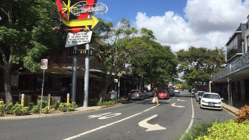
Stop 7, The High Street, traces Logan Road’s shopping strip: in the 1890s, the page says, it was a strip of small stores with a grocer, greengrocer and butcher supplying daily necessities. It says the Alhambra Theatre, once at 38 Old Cleveland Road opposite the hotel, introduced Stones Corner to American films and survived into the 1960s. The page adds that the Drouyn drum factory at 382 Logan Road was Australia’s only local concert-band instrument maker, and that the factory closed in the late 1980s.
Stop 8, the former Salvation Army Hall at 3 Ellis Street, is described as having been built in 1890 as the Oddfellows’ Hall and officially opened on 4 June that year. The page says the hall was bought by the Salvation Army in 1925, and that it remained a key hub for the Salvation Army and the broader community until 1998.
An air raid shelter that became a bus shelter
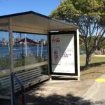
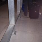
Stop 4 is the Stones Corner Air Raid Shelter at 286 Logan Road, which the page says was built in 1942 during the Second World War to protect local residents during air raids. The page says it was designed with removable walls, which were taken away after the war, turning the structure into the bus shelter seen today. It credits the surface shelters across the city to City Architect Frank Gibson Costello and says this one was a park shelter type.

Frequently asked questions
How long is the Stones Corner Heritage Trail?
Per the source read on 13 November 2026: The Council’s Stones Corner Heritage Trail page, read on 13 November 2026 (the linked trail guide is shown as last modified 15 April 2025), describes a 2.3 kilometre self-guided trail with 11 points of interest through the historic high street and nearby landmarks.