




The Scenic Rim Regional Council’s Local Heritage Register (the PDF updated 26 November 2018, read on 13 November 2026) has an entry for Knoll Road and Old Knoll Road, Tamborine Mountain, listed as item 55 in the theme Moving goods, people and information. The entry’s history is stated to have been prepared by the Heritage Branch, Department of Environment and Heritage Protection, on 8/12/2014.
What the 2014 history and 2018 register describe
In the register as updated on 26 November 2018, the entry’s description says Knoll Road and Old Knoll Road form a 3.5km route winding northwest from the town of North Tamborine. It says Knoll Road begins at the north end of Main Street, is sealed with bitumen, and descends gradually for 1.6km. According to that description, a metal gate marks the start of the unsealed part of the route, Old Knoll Road, which passes through a densely forested area of Tamborine National Park and descends for 1.9km before being crossed by Tamborine Mountain Road. It describes the Knoll itself as a rounded high point at the northern edge of the mountain.
The origins of the road in the 1877 history
The history says the road was originally formed in 1877. It describes Knoll Road as the first road used by settlers on the mountain, with local significance as a facilitator of farming and tourism on the plateau. The entry says it was the only route from Tamborine Village up to the north end of the mountain until 1924, when it was replaced by Tamborine Mountain Road.
According to the entry, timber getters started working on the mountain in the 1860s and formed some tracks, and the first applications for selections at the north end came in late 1875. It names John O’Callaghan as the first European to live on the mountain, from November 1875. The entry says that in early 1876 a petition was made to the Minister for Works for money to make a road to the top of Tamborine Mountain. It records that by July 1880 an article described ‘not a very bad road’, Knoll Road, as the only accessible entrance to the top of the mountain for horse or dray traffic.
Surveys and farmers’ produce
The entry says that in 1882 it was stated at a Tabragalba Divisional Board meeting that mountain selectors had ‘absolutely no road to their holdings from Tambourine’. It adds that a survey began in November 1882 and that by 1887-88 maps show a surveyed Knoll Road. According to the entry, farmers at the north end of the mountain used Knoll Road to get their produce to Tamborine Village.
The entry says tourist accommodation at the north end of the mountain was first built in the 1890s, and that John Cameron built a boarding house, ‘Yuulong’, after buying land in 1893. It says that in 1898 the Geissmann family arrived in North Tamborine and built a boarding house, ‘Capo Di Monte’. The entry states that the Knoll section of Tamborine National Park was first proclaimed in 1954.

Early cars and the new Main Road
The history records that the first car up the mountain was a 5 horsepower Oldsmobile, which came via Knoll Road in January 1907. It says that, with grades of one in three to climb, the assistance of William Curtis, Barney Geissmann and their horses was required to help the car get up to Capo Di Monte. The entry adds that the downward trip required extra braking power, provided by tying two stout saplings to the rear axle. It reports that in August 1915 a Ford car travelled from Tamborine Village up the mountain, apparently by Knoll Road.
The entry says the route for Tamborine Mountain Road was surveyed in 1920 and that in December 1921 it was gazetted as one of Queensland’s first seven Main Roads. It states that the new road was completed in 1924. The entry says the steep original route up the mountain to the Knoll was no longer used by vehicles after 1924.
Trees, trails and heritage significance
It says the section between the Knoll and North Tamborine continued to be used to access the Knoll section of Tamborine National Park and the residences alongside the road. According to the entry, in the late 1970s there were plans to cut down the trees lining this section and turn it into a straight two-lane road, but locals opposed this and the present winding sealed road was formed instead. The history, prepared on 8/12/2014, says the unsealed section down the mountain from the Knoll is only used by Queensland Parks and Wildlife, the SES and Rural Fire Brigade vehicles, and that it is also a designated horse trail that attracts some bush walkers. Access can change: check the current position with Scenic Rim Regional Council and Queensland Parks and Wildlife Service before visiting.
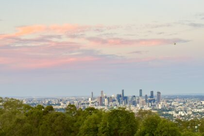
The statement of significance says the route is important in demonstrating the role of roads in facilitating agricultural settlement and tourism on Tamborine Mountain. It says the course of the unsealed Knoll Road enables an understanding of the difficulties for early settlers in accessing their land. The statement also records aesthetic value in the picturesque qualities of the road’s winding course through the forest, with views to distant mountains from the steepest, upper section. The statement also calls the road ‘the first road up to the plateau of the mountain’ and the only access for wheeled traffic between Tamborine Village and the north end of Tamborine Mountain between 1877 and 1924.
Related reading
Readers interested in listed buildings in Brisbane itself can turn to the Brisbane Heritage-Listed Buildings Guide.
Frequently asked questions
What does the register say about the first car up Tamborine Mountain?
Per the source read on 13 November 2026: The history records that the first car up the mountain was a 5 horsepower Oldsmobile, which came via Knoll Road in January 1907.
What does the register say about vehicle use of Old Knoll Road?
Per the source read on 13 November 2026: The history, prepared on 8/12/2014, says the unsealed section down the mountain from the Knoll is only used by Queensland Parks and Wildlife, the SES and Rural Fire Brigade vehicles, and that it is also a designated horse trail that attracts some bush walkers. Access can change: check the current position with Scenic Rim Regional Council and Queensland Parks and Wildlife Service before visiting.