Council describes Brisbane Metro as a high-capacity, high-frequency public rapid transit system that travels on the existing busway infrastructure. This explainer sets out what Council’s official Brisbane Metro website says about the routes, the vehicles and boarding, with details that can change dated to 10 November 2026. Ridership figures are not covered because the pages used here do not give any.
What Brisbane Metro is
Council describes Brisbane Metro as a high-capacity, high-frequency public rapid transit system linking the city to the suburbs. In 2025, Brisbane City Council launched two new metro routes, M1 and M2, alongside a new bus network.
The website says the metros include the high-quality and high-capacity features of light rail vehicles, avoiding the need for tracks and overhead line equipment by travelling on the existing busway infrastructure. The same page says the project is fully funded in partnership with the Australian Government.
The two routes and their stops
At 10 November 2026, the Brisbane Metro page lists two routes. M1 runs between Eight Mile Plains and Roma Street. M2 runs between UQ Lakes and the Royal Brisbane and Women’s Hospital (RBWH).
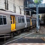
The page’s FAQ names the stations each route services. For M1 they are Eight Mile Plains, Upper Mt Gravatt, Griffith University, Holland Park West, Greenslopes, Buranda, Mater Hill, South Bank, Cultural Centre, City Hall / King George Square and Roma Street. For M2 the list begins at UQ Lakes, Boggo Road, PA Hospital, Mater Hill, South Bank, Cultural Centre, City Hall / King George Square and Roma Street. It then continues to Normanby, QUT Kelvin Grove, Herston and RBWH.
Council also publishes an M1 and M2 route map as a PDF, which the page lists as last modified 30 April 2025. The page directs people to the Translink journey planner to plan metro and bus journeys.
How often they run
The page gives frequency in two places, and this article reports each as worded rather than merging them. At 10 November 2026, the route overview says the two routes run every 5 minutes on weekdays and 24 hours on weekends. The FAQ words it differently: weekday services operate at a 5 minute frequency from approximately 6am to 6pm, and every 10-15 minutes before 6am and after 6pm. For weekends it says services operate at a 10-15 minute frequency, with 24-hour services from Friday evening through to Sunday evening. The two wordings are not reconciled here; check the Translink timetable for current service times.
The vehicles
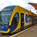
The fleet page describes a bi-articulated design in which each metro can comfortably transport 150 passengers, and 170 passengers in event mode. A video transcript on the same page says the metros are 24.4 metres long, approximately double the length of a standard bus. Council lists 64 seats, including 10 priority seats. There are 3 double doors for all-door boarding and 3 large mobility bays in the front compartment.
Other listed features include an automated ramp at the front door for prams and mobility devices and a low-floor design. The vehicles also have in-built USB A and C charging points and onboard Wi-Fi. Council says each vehicle has an automatic ramp in the first compartment that can be deployed on request.
Power and charging
The metros are battery electric. Council says fast charging takes just over 6 minutes and is delivered by an overhead pantograph. Fast chargers are installed at UQ Lakes station, Countess Street at Petrie Terrace, Ernie’s Roundabout at Herston, and the Rochedale metro depot. Council says slow charging will be used to charge the metros at the Rochedale metro depot. The infrastructure page describes the fleet as electric metros with zero tailpipe emissions.
How to board and pay
At 10 November 2026, the fleet page’s video transcript, which is undated, gives the boarding steps. To catch a metro, a passenger still needs to hail the service or use the help phone on the platform to request it. To enter or exit, passengers press the yellow button in the centre of one of the three doors. The transcript asks passengers to wait until others have exited before boarding and then tap on with a GoCard. For fares and ticket types, see Go Card and Public Transport Tickets Explained.
There is a separated driver cabin just before the first compartment, so communicating with the driver differs from a regular bus. Passengers who need the ramp press the blue ramp request button on the left panel of the first compartment door. The transcript notes that customers with a pram or mobility device will not be able to move between compartments. Each metro has six help points, and to call the driver a passenger presses the red button and holds it for three seconds.
For the wider bus network that runs alongside the metro routes, see Brisbane Buses Explained. For the rail network, see Brisbane Trains Explained.
Infrastructure behind the routes
At 10 November 2026, the infrastructure page says Council partnered with Brisbane Move, comprising construction lead ACCIONA and design lead Arup. The Adelaide Street tunnel opened to bus and metro operations on Monday 29 September 2025, providing a connection between the Inner Northern Busway and South East Busway. City Hall / King George Square station was upgraded to connect to that tunnel and has new platform screen doors to support metro services.
At 10 November 2026, the infrastructure page also says Council converted Victoria Bridge into a pedestrian and active transport bridge with 3 lanes for metros and buses. Buranda busway station was upgraded and extended to cater for metro services, and Cultural Centre station has an additional platform, Platform 3, for buses to West End and Highgate Hill. At 10 November 2026, the page describes major construction in South Brisbane, North Quay, the CBD and Buranda as now complete, with minor maintenance works continuing in the CBD, South Brisbane and at Buranda busway station.
Possible expansion
At 10 November 2026, the Brisbane Metro page says Council is working with the Australian and Queensland governments to explore expanding Brisbane Metro to the north, east, further south and to the airport. It says a business case will confirm alignment, depot locations, network improvements, infrastructure enhancements and delivery phasing for potential new routes. The page lists a public survey closing at 11.59pm on Sunday 13 December 2026.
Frequently asked questions
What are the Brisbane Metro routes?
At 10 November 2026, Brisbane City Council lists two routes: M1 from Eight Mile Plains to Roma Street, and M2 from UQ Lakes to the Royal Brisbane and Women’s Hospital.
How often do Brisbane Metro services run?
At 10 November 2026, Council’s FAQ says weekday services run at a 5 minute frequency from approximately 6am-6pm and every 10-15 minutes outside those hours, with 10-15 minute weekend services and 24-hour services from Friday evening to Sunday evening.
How do you board a Brisbane Metro?
At 10 November 2026, Council’s fleet page says to hail the service or use the platform help phone, press the yellow button on a door to enter or exit, and tap on with a GoCard after others have exited.
How big is a Brisbane Metro vehicle?
At 10 November 2026, Council says each metro is 24.4 metres long, can comfortably transport 150 passengers (170 in event mode) and has 64 seats.