


This guide looks at Clayfield through Brisbane City Council heritage register entries and Council park records.
The Enderley Road precinct and nearby houses
At 13 November 2026, the Brisbane Heritage Register “Enderley Road Heritage Precinct” page (page revised August 2024) says that the Enderley Road precinct is described as having large, detached, often architect designed houses dating from the late 19th century to the Interwar period, generously sized subdivision patterns and mature street plantings. Per the Brisbane Heritage Register “Enderley Road Heritage Precinct” page (page revised August 2024) at 13 November 2026, the entry’s address summary lists 94, 98 and 102 Alexandra Rd, Ascot, 92 Alexandra Rd, Clayfield, 19 Craven St, Clayfield and Enderley Rd numbers 24, 26, 32, 40, 52, 57, 58, 60, 63, 64, 67, 71, 72, 77 and 82, Clayfield. As read on 13 November 2026, the Brisbane Heritage Register “Enderley Road Heritage Precinct” page (page revised August 2024) reports that from the 1880s, families on the street established homes which reflected their socio-economic standing in the community. The Brisbane Heritage Register “Linstarfield” page (page revised June 2022) states, as of 13 November 2026, that Linstarfield is an elegant Federation era timber house that was built on two acres circa 1917 for Percy Rylance, a successful mine owner and the father of Brisbane architect Mervyn Rylance. The Brisbane Heritage Register “Linstarfield” page (page revised June 2022), read on 13 November 2026, records that in 1919 the property was purchased by HG Noble, another wealthy mine owner, who expanded the grounds to six acres. According to the Brisbane Heritage Register “Linstarfield” page (page revised June 2022) as read on 13 November 2026, the improvements made under HG Noble included a stable complex (since demolished) to house his racehorses and an imposing sandstone boundary wall which today extends into Alexandra Road. At 13 November 2026, the Brisbane Heritage Register “Delcotta” page (page revised September 2020) says that Delcotta is a fine example of an Interwar Old English style residence designed by influential Brisbane architect EP Trewern. Per the Brisbane Heritage Register “Delcotta” page (page revised September 2020) at 13 November 2026, Delcotta was built 1929-30 for Mr and Mrs A. Ure McNaught.
Churches on Oriel Road, Bonney Avenue and Queens Road
As read on 13 November 2026, the Brisbane Heritage Register “St Agatha’s Catholic Church” page (page revised September 2020) reports that St Agatha’s Catholic Church is at 52 Oriel Road, Clayfield. The Brisbane Heritage Register “St Agatha’s Catholic Church” page (page revised September 2020) states, as of 13 November 2026, that St Agatha’s Catholic Church is a Romanesque style polychromatic brick church built in 1925 to the design of local architect J.P. Donoghue during his partnership with Hennessy, Hennessy, Keesing and Co. The Brisbane Heritage Register “St Agatha’s Catholic Church” page (page revised September 2020), read on 13 November 2026, records that a presbytery located in the grounds was also built around the time the church was constructed. According to the Brisbane Heritage Register “St Agatha’s Catholic Church” page (page revised September 2020) as read on 13 November 2026, St Agatha’s Catholic Church has undergone a number of alterations and extensions throughout its lifetime, including the addition of two side chapels and a sacristy. At 13 November 2026, the Brisbane Heritage Register “St Marks Anglican Church” page (page revised September 2020) says that St Mark’s Anglican Church is at 103 Bonney Avenue, Clayfield. Per the Brisbane Heritage Register “St Marks Anglican Church” page (page revised September 2020) at 13 November 2026, St Mark’s Anglican Church is a low set, brick and tile church constructed in 1964 as a war memorial church. As read on 13 November 2026, the Brisbane Heritage Register “St Marks Anglican Church” page (page revised September 2020) reports that St Mark’s Anglican Church was designed by the Brisbane architectural firm of Conrad and Gargett and replaced an earlier timber church (built in 1888) that was moved from Albion to this site in 1899. The Brisbane Heritage Register “St Marks Anglican Church” page (page revised September 2020) states, as of 13 November 2026, that stained glass windows commemorating the fallen of both World War I and World War II are among the elements of the first church incorporated into the modern church. The Brisbane Heritage Register “Scots Presbyterian Memorial Church” page (page revised June 2022), read on 13 November 2026, records that the original Scots Presbyterian Church was designed by AB Wilson, architect, and built by James Watterson in Balmain Street, Maida Hill. According to the Brisbane Heritage Register “Scots Presbyterian Memorial Church” page (page revised June 2022) as read on 13 November 2026, the Scots Presbyterian Church was moved from Balmain Street to a new site and re-erected and enlarged during 1904. At 13 November 2026, the Brisbane Heritage Register “Scots Presbyterian Memorial Church” page (page revised June 2022) says that additions and alterations were made in 1954, including encasing the original building in brick veneer with buttressed walls and a new roof, and the church was renamed the Scots Presbyterian Memorial Church.
Houses, a school and its memorials
Per the Brisbane Heritage Register “Rangemoor” page (page revised September 2020) at 13 November 2026, Rangemoor is a timber residence built in 1907 for John W.H. Grout, merchant, soldier and Spanish Vice-Consul, and his wife, Winnifred. As read on 13 November 2026, the Brisbane Heritage Register “Rangemoor” page (page revised September 2020) reports that Rangemoor was designed by prominent Queensland architect Robin S. Dods. The Brisbane Heritage Register “71 Oriel Road, Clayfield” page (page revised September 2020) states, as of 13 November 2026, that the three allotments at 71 Oriel Road were acquired by Albion pharmacist George Frederick Haenke in January 1914. The Brisbane Heritage Register “71 Oriel Road, Clayfield” page (page revised September 2020), read on 13 November 2026, records that plans for the house were drawn up by his older brother, Ipswich architect Martin William Haenke. According to the Brisbane Heritage Register “Eagle Junction State School, Memorial gates, fence & trees” page (page revised June 2022) as read on 13 November 2026, Eagle Junction State School, originally known as Clayfield School, was built in 1895 in response to the growing local population and an increasing need for a permanent school in the local area. At 13 November 2026, the Brisbane Heritage Register “Eagle Junction State School, Memorial gates, fence & trees” page (page revised June 2022) says that Eagle Junction State School was almost immediately overcrowded, forcing extensions of the main school building in 1897, 1905 and 1911. Per the Brisbane Heritage Register “Eagle Junction State School, Memorial gates, fence & trees” page (page revised June 2022) at 13 November 2026, wrought iron memorial gates were erected outside the school in 1924 to honour the memory of former staff and students who had served in World War I. As read on 13 November 2026, the Brisbane Heritage Register “Eagle Junction State School, Memorial gates, fence & trees” page (page revised June 2022) reports that a memorial library was opened in 1949 in honour of those who had served in World War II.
Parks in the Council dataset
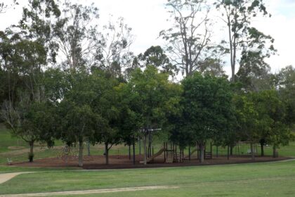
At 13 November 2026, the Brisbane City Council park-locations open dataset (API records for the suburb “CLAYFIELD”, which shows no visible page date; dataset metadata gives modified 30 September 2026 (UTC)) says that the dataset lists 2 park records for the suburb CLAYFIELD (the API count for the query). At 13 November 2026, the Brisbane City Council park-locations open dataset (API records for the suburb “CLAYFIELD”, which shows no visible page date; dataset metadata gives modified 30 September 2026 (UTC)) says that the dataset lists Milman Street Park at 60 Milman Street. At 13 November 2026, the Brisbane City Council park-locations open dataset (API records for the suburb “CLAYFIELD”, which shows no visible page date; dataset metadata gives modified 30 September 2026 (UTC)) says that the dataset lists Wagner Road Park at 90 Wagner Road.
Related reading
For the wider register, see Brisbane Heritage-Listed Buildings Guide. For parks across the city, see Parks in Brisbane Worth Knowing: A Guide.
Frequently asked questions
What does the register say about the Enderley Road precinct in Clayfield?
At 13 November 2026, the Brisbane Heritage Register “Enderley Road Heritage Precinct” page (page revised August 2024) says that the Enderley Road precinct is described as having large, detached, often architect designed houses dating from the late 19th century to the Interwar period, generously sized subdivision patterns and mature street plantings.
When was St Agatha’s Catholic Church at Clayfield built?
At 13 November 2026, the Brisbane Heritage Register “St Agatha’s Catholic Church” page (page revised September 2020) says that St Agatha’s Catholic Church at 52 Oriel Road is a Romanesque style polychromatic brick church built in 1925 to the design of local architect J.P. Donoghue during his partnership with Hennessy, Hennessy, Keesing and Co.
When was Eagle Junction State School built?
At 13 November 2026, the Brisbane Heritage Register “Eagle Junction State School, Memorial gates, fence & trees” page (page revised June 2022) says that Eagle Junction State School, originally known as Clayfield School, was built in 1895 in response to the growing local population and an increasing need for a permanent school in the local area.